Software About Donate
All Software
Version 1.5.4 · Windows · Freeware

Batch PhotoTools

Reverse geocode photos in bulk — find where every photo was taken.

Your camera wrote down where every photo was taken, as numbers nothing ever reads. Batch PhotoTools turns them into words — country, city, neighborhood, and the actual place, the restaurant or the waterfall — and writes them into the photos themselves, a whole library at a time. Then it gives you a browser fast enough to enjoy the result.

Download Free User Manual What's New 50 MB · Windows 10/11 · No subscription
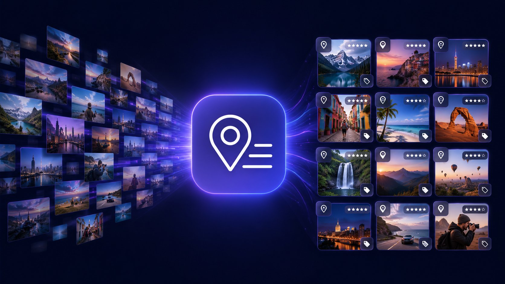
Batch PhotoTools — a stream of photos flows through the app and comes out organized with location, rating and keyword tags
Before
Location 60.1699, 24.9384
Country
City
Place
After
Location 60.1699, 24.9384
Country Finland
City Helsinki
Place Restaurant Savoy
Not just the city

"Türkiye" doesn't tell you much. "Hagia Sophia" does.

Anything can put a photo in a country. What you actually want back is the restaurant where you ate that meal, the waterfall you walked to, the hotel you stayed in. Batch PhotoTools works down to that level, using OpenStreetMap data for the countries you photograph.

It is quick about it: a holiday folder is done while you make coffee, and a whole library in an evening you spend elsewhere. There is no API key to sign up for and nothing metered per photo.

It also learns. Save "Home", "the cabin" or your regular café once, and every future photo taken near it is labelled without asking you anything.
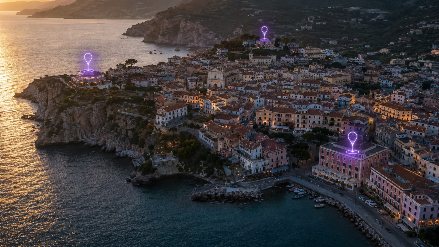
A coastal town from the air with glowing markers over three specific buildings

Not the town. The three places in it that meant something to you.

The quiet one

Point it at D:\ and browse everything you own.

Not a folder. The whole drive. Batch PhotoBrowser reads straight through however you filed things — the albums you curated for years, the camera dumps you never touched, the folder called "New folder (3)" — and gives you one stream of photographs.

Then you put it in whatever order interests you: by date, by place, by rating, grouped by year or country or keyword. No import, no catalogue to build, no waiting for it to think. Your filing stops being the thing that decides what you can find.

This is the part people do not expect and end up using most. It works just as well on a library that was never organised at all.
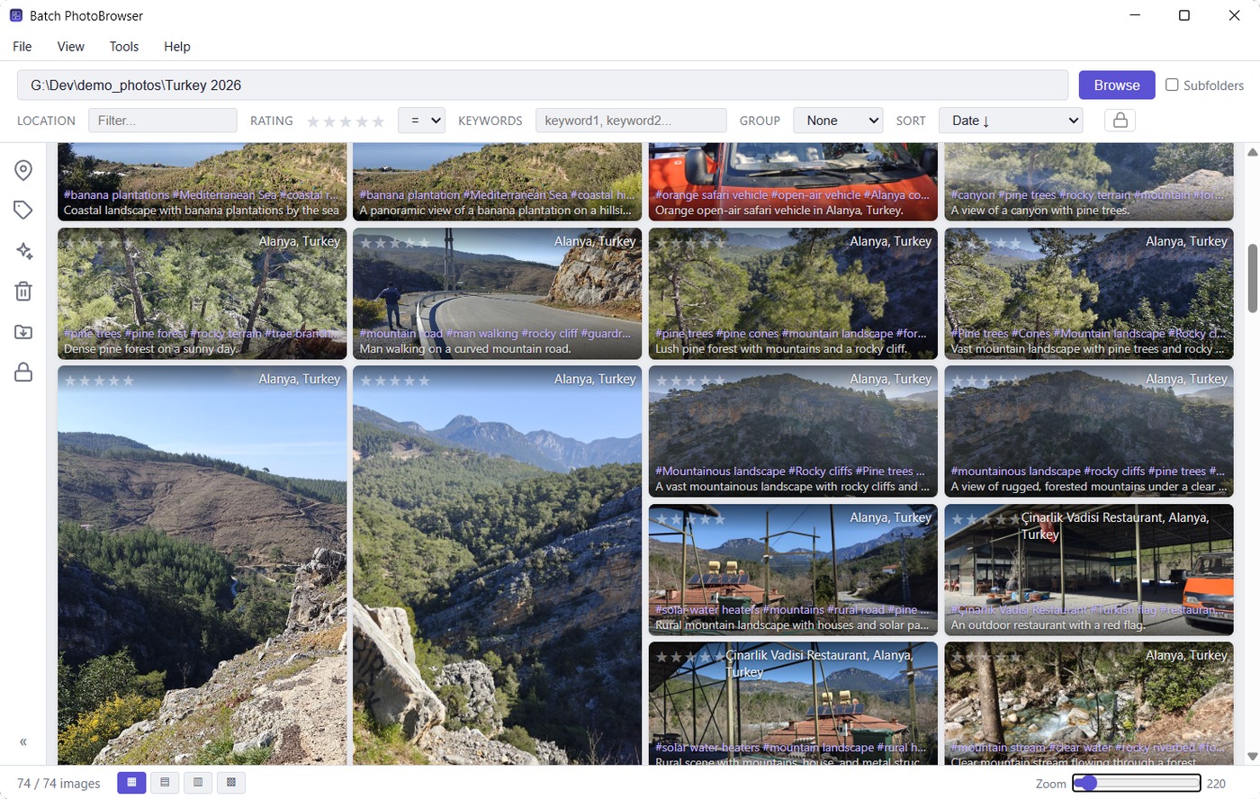
A photo gallery where every image shows its place name, keywords and description

Every photo carrying its place, its keywords and a description — written into the files, not a database.

The fun one

Watch your whole life scattered across a map.

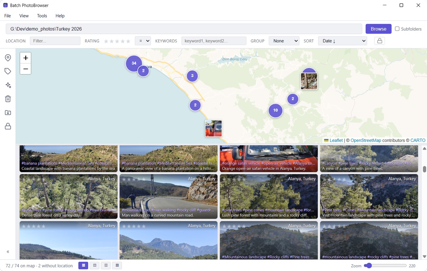
Open the map above the gallery and every photo you have ever geotagged lands on it. Zoom out and it is a decade of travelling in one glance. Zoom in on a street you half remember and the photographs are right there.

It is also how you choose: the gallery underneath always shows exactly what is inside the map's current view, and sorting, grouping, ratings, batch editing and full-screen viewing all keep working on that selection.

Photos you mark private stay hidden here too — off the gallery, off the map, and out of anything you stream to a TV until you unlock them.
A map above the photo gallery, with clustered photo markers narrowing what the gallery shows

The count underneath always accounts for every photo: on the map, without a location, or unreadable.

Photos with no GPS

Your folder names are evidence. It uses them.

Older cameras recorded no coordinates. Phones with location switched off record none. Scanned prints never had any. Batch PhotoTools works those out with AI — from the picture, the date, and the names you gave your own folders. A hillside is a hillside anywhere; the same picture in 2019 Tenerife → el teide is Mount Teide.

It does it with you rather than behind your back. It asks which countries first, then proposes a place for each group of photos with the photos beside it, and you approve, pick another suggestion, choose your own, or skip — photo by photo if you want.

When it isn't sure, it writes nothing. A wrong location is worse than an empty one, and a coordinate that is really just the middle of an island would put a fortnight's holiday in a field.
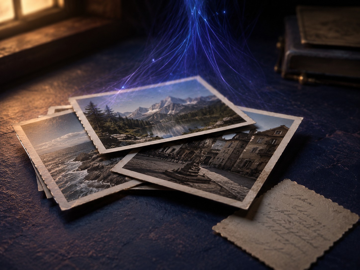
A stack of old printed holiday photographs, none of them carrying any GPS data

Photographs that never carried coordinates. What locates them is the album they were kept in.

Two you'll live in, five for the jobs nobody enjoys

Find the blurry and the broken photos automatically, get different photo apps to agree about faces and keywords, keep the saucy ones out of the family slideshow, and clear out duplicates without losing the copy you spent an evening captioning.

Batch Geolocate icon

Batch Geolocate

"There are so many apps that do something like this but I never found one that actually does it for my huge photo library. I didn't want to sign up for APIs, I wanted it to detect my home and my cabin, I wanted it to traverse my whole library. And I wanted to get the restaurant name where I took a picture of that awesome sushi."

The one that does the work. Point it at a folder, tick the passes you want, and it fills in country, state, city, neighborhood and the specific place for every photo that has coordinates — and works out the ones that don't.

  • Tested on libraries of 500,000+ photos
  • Learns your own places and uses them first
  • No API signup, no rate limiting — local OpenStreetMap data
  • Optional AI for landmarks, descriptions and keywords
Batch PhotoBrowser icon

Batch PhotoBrowser

"After I got the location data to my photos I realized none of the many photo browsers I have actually made it fun to use it across my folder storage system. I wanted an app that is FAST with my photo browsing, supports all the location and keyword data, and hides what I don't want to show to my relatives."

Where you enjoy the result. A fast photo and video browser over the folders you already have, with location, keywords and ratings visible on every thumbnail, filtering and grouping by any of them, and editing that applies to a whole selection at once.

  • Browse any folder — no import, no catalog, no waiting
  • Browse on a map: pan and zoom to choose the photos you see
  • Filter and group by location, keywords, rating, or person
  • Paint location and keyword metadata onto photos by dragging
  • Mark photos private and hide them by default
Batch MetadataSync icon

Batch MetadataSync

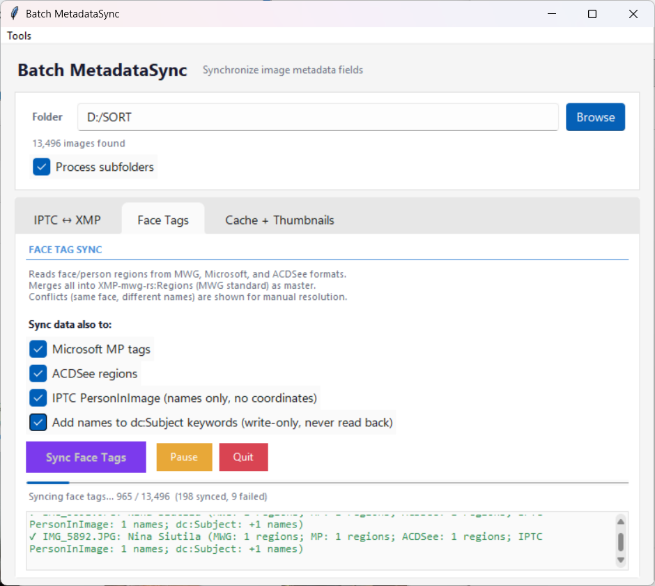
"I use all those different apps to manage my photos and none of them work well together. Use the force and sync data across the apps! Now ACDSee and Lightroom see the same faces!"

Different photo apps store metadata in different formats. MetadataSync keeps your IPTC and XMP fields consistent across Lightroom, Capture One, ACDSee, Google Photos, and more. Also synchronizes face tags between different tagging standards.

Batch PhotoRater icon

Batch PhotoRater

"Do I really need all those blurry or too dark photos? I wanted to automate finding them so that they don't keep lowering my photo library quality year after year."

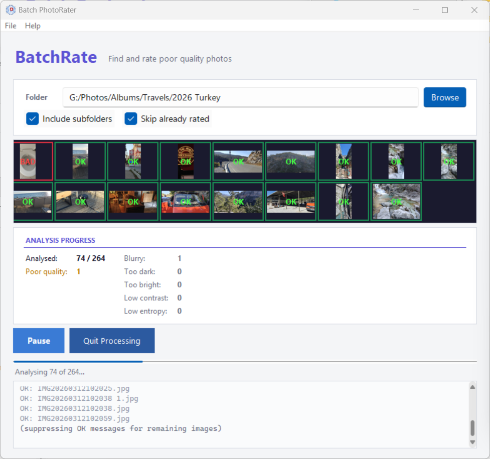
Finds blurry, too dark, too bright, and low-contrast photos automatically. Review them one by one with a rating dialog, batch-rate them, or send them to the recycle bin. Great for cleaning up after a big trip.

Batch PhotoFixer icon

Batch PhotoFixer

"To be honest — there might be a better one out there. But this isn't bad, it worked for some of my photos, and it does know when there is nothing to salvage. But the best thing is — your broken photos are found as a side quest."

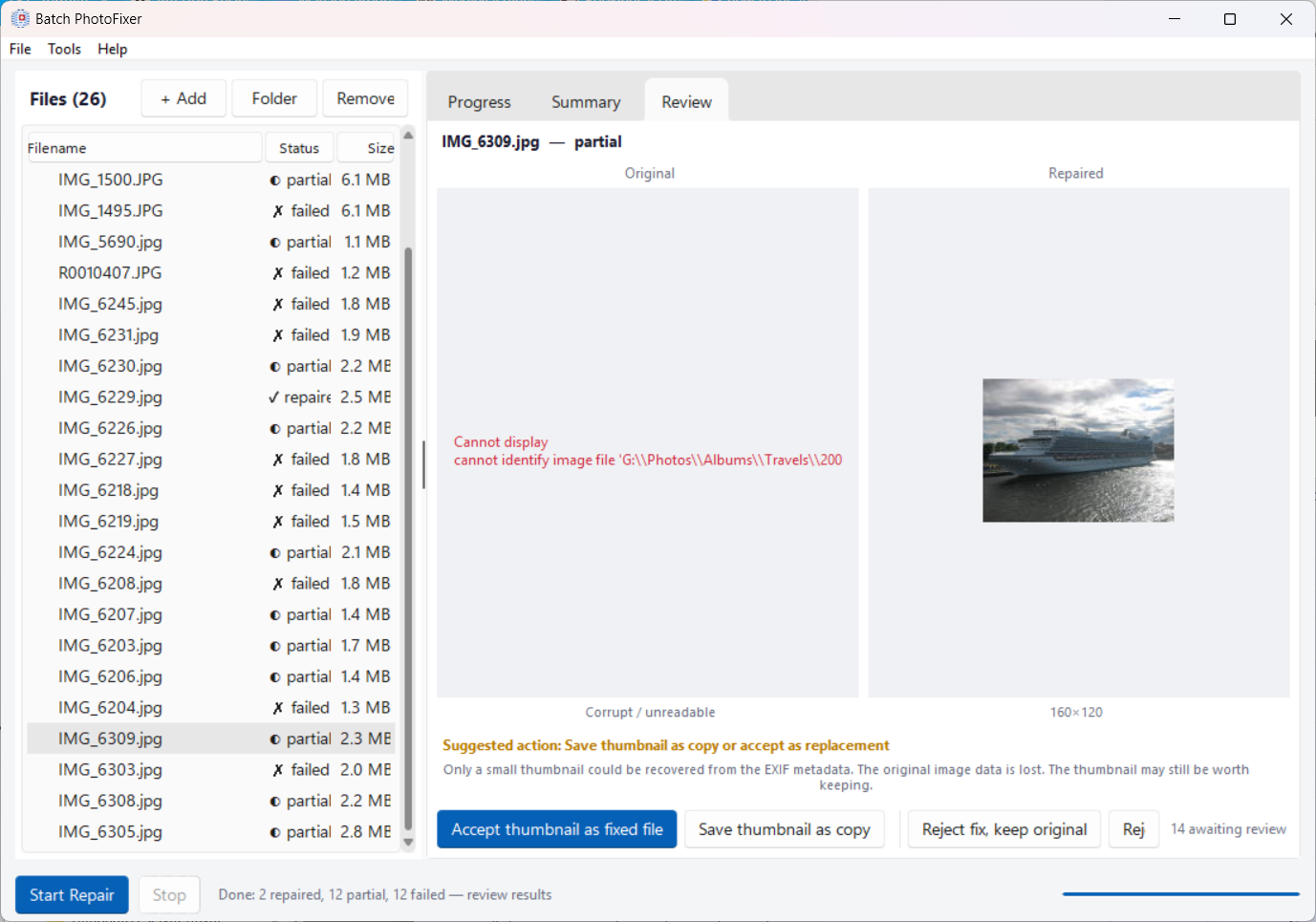
A six-stage repair pipeline for damaged JPEG files. Fixes broken headers, corrupted tables, and incomplete data. Never modifies your originals — you review the repair side-by-side before accepting. Recovers photos other tools give up on.

Batch Streamer icon

Batch Streamer (new)

"Once my library was organized, I wanted to actually watch it — on my phone in bed, or on the TV with the family. Not upload everything to some cloud, just show it on the screen in the room."

Stream your photos and videos to any phone, tablet, or TV on your home Wi-Fi — open the gallery in a browser by scanning a QR code, run a full-screen slideshow, or Cast the exact view you're browsing straight to a Chromecast. Read-only and PIN-protected; nothing leaves your network.

  • Watch on your phone, tablet, or TV — no cloud, no upload
  • Filter what you share by folder, rating, keywords, or location
  • Full-screen slideshow with photos and video playback
  • Cast to TV (beta) — Chromecast support
Batch Background Processor icon

Batch Background Processor (new)

"Once everything was set up, I just wanted my whole library to be ready — thumbnails built, locations filled in, duplicates found — without sitting there watching a progress bar. Do it while I'm away, and get out of my way the moment I come back."

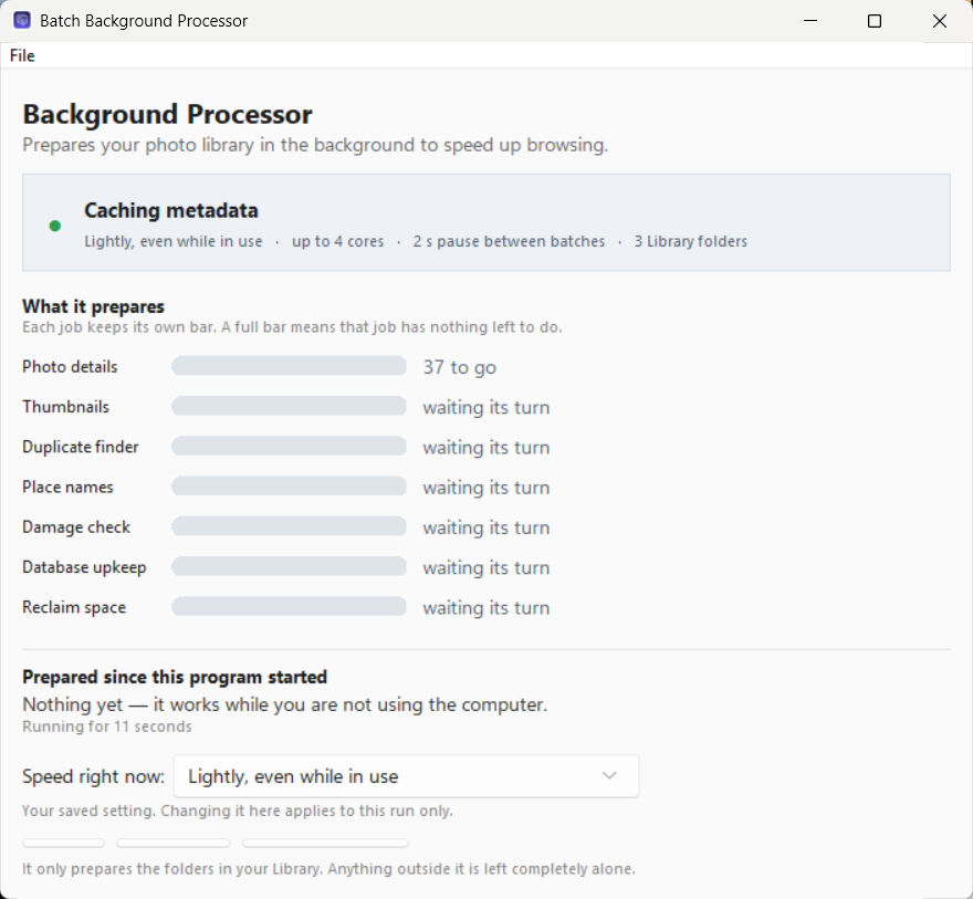
A quiet helper that prepares your entire library in the background so the browser opens instantly. It reads photo details, builds thumbnails, finds duplicate copies, and fills in locations — by default only while you're away from the computer, never on battery, stepping aside the instant you touch the mouse. It never changes your photos, and the other tools never wait for it.

  • Gets your library ready so browsing is instant
  • Works only when the computer is idle — you never feel it
  • Never on battery, stops the moment you return
  • Can start with Windows and wait in the notification area
  • Every job on screen with its own progress bar

How batch reverse geocoding turns GPS into place names

1

Point to a folder

Select any folder of photos. Batch PhotoTools finds all images with GPS data — even in subfolders.

2

Click Start

The app groups nearby photos, reverse geocodes each GPS coordinate into a location name, and discovers the specific POI using local OpenStreetMap data.

3

Metadata is written

Standard IPTC/XMP fields are filled in each image. Lightroom, Capture One, Google Photos — they all read it instantly.

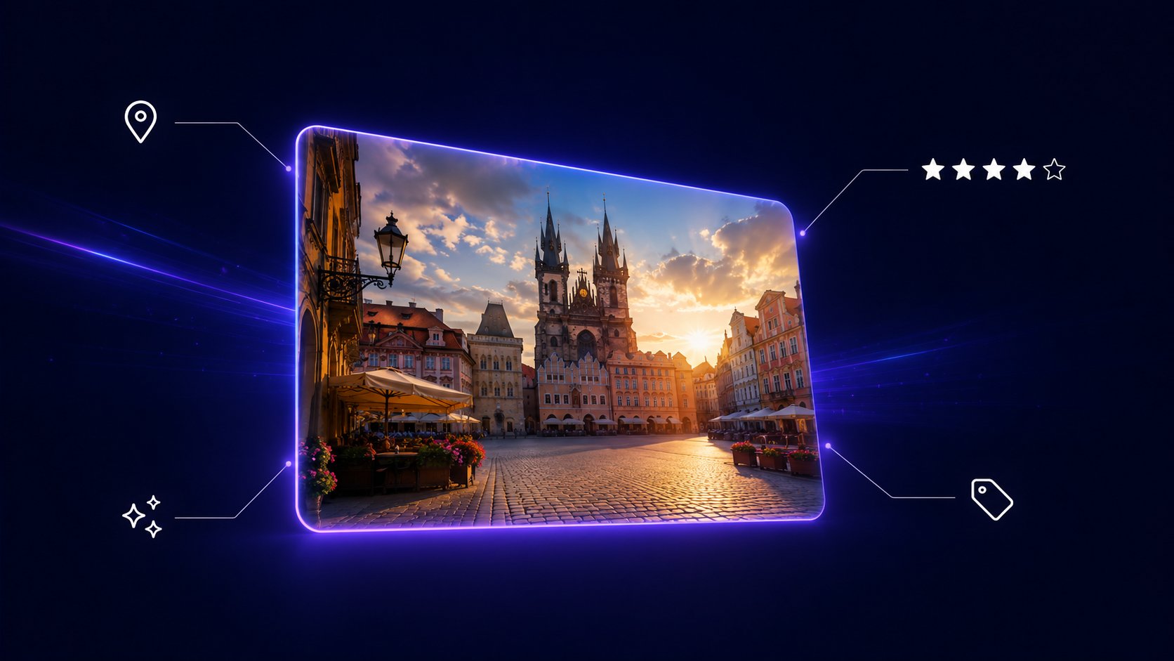
A single travel photo enriched with location, star rating, keyword and AI metadata

Built for clarity, not complexity

Click any screenshot to see it full size.

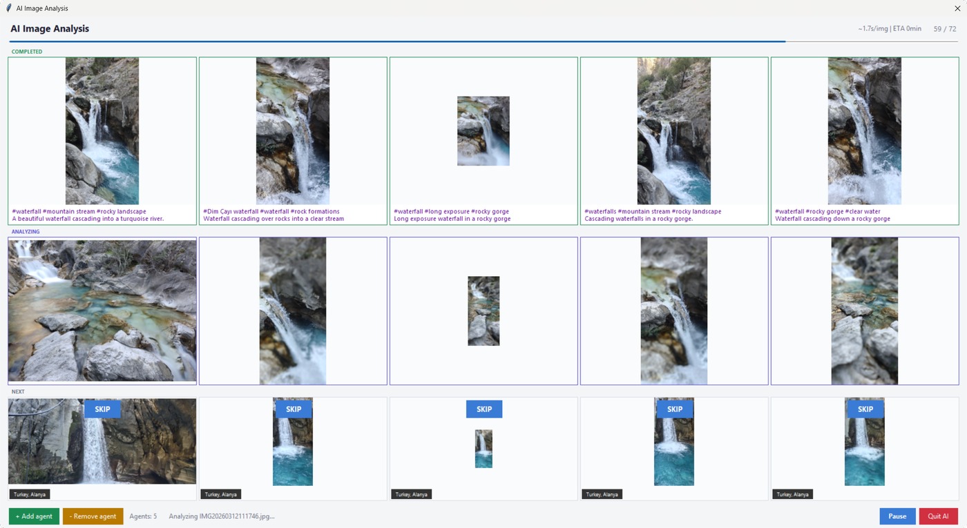
Batch PhotoTools AI analysis window writing descriptions and keywords for photos
Several photos described at once, so a folder does not take all evening
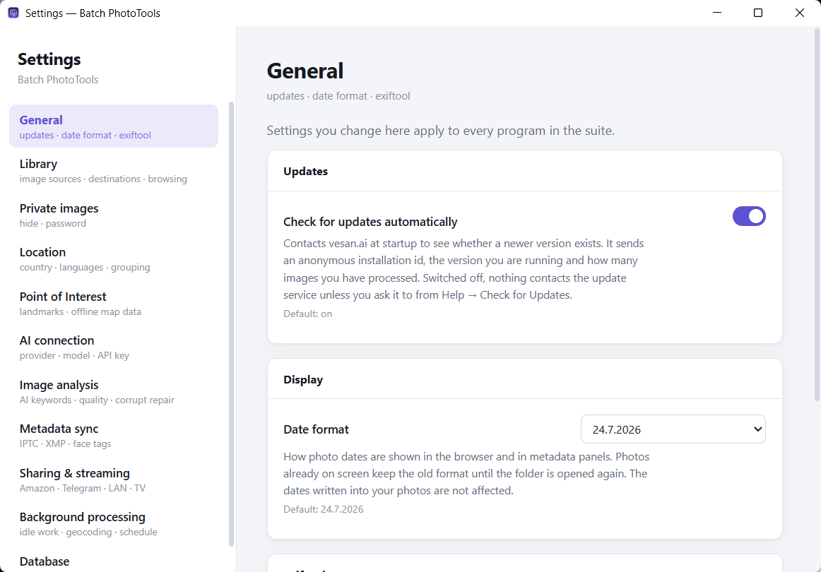
The shared settings window used by all seven Batch PhotoTools applications
One settings window for all seven programs, arranged by subject
Batch PhotoFixer repairing a damaged JPEG, original and repair side by side
Batch PhotoFixer repairing photos it found damaged, original beside repair
Batch PhotoRater finding blurry, dark and low-contrast photos
Batch PhotoRater — five quality measures, each with its own threshold
Batch MetadataSync synchronising IPTC and XMP metadata between photo applications
Batch MetadataSync — IPTC against XMP, and face tags across formats
The Batch PhotoTools background processor preparing a photo library
The background processor, with every job on its own bar
Batch Streamer — the same photo library streamed to a TV, a laptop and a phone over the home network
Stream your library to any screen in the house — phone, laptop or TV
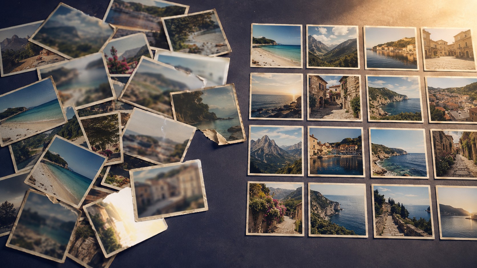
A pile of duplicated, blurred and torn photographs on the left resolving into one clean grid on the right
Duplicates cleared, the damaged repaired, the bad ones weeded — the same library, sorted out

Built to manage all those old and new photos

No API signup, no per-photo cost

Nothing to register for and nothing metered. Download OpenStreetMap data for the countries you photograph and the point-of-interest searches run against your own disk instead of a queue on a public server.

Safe by default

Only fills empty metadata fields — your existing captions, keywords, and locations are never overwritten unless you explicitly choose to.

Private photos stay private

Mark photos private and they are hidden by default — off the gallery, off the map, and out of anything you stream to a phone or a TV until you unlock them with a password.

Standard metadata

Writes industry-standard IPTC/XMP fields. Compatible with Adobe Lightroom, Capture One, Google Photos, digiKam, and any app that reads EXIF data.

AI-powered analysis

Optionally use AI to identify landmarks, statues, and buildings in your photos. Writes descriptions, keywords, and quality ratings automatically. Pick your model from a ready-made list, or point it at any OpenAI-compatible service.

Finds duplicate photos

Identical copies are found quietly in the background and grouped by where they live — your organised library, an unsorted cloud folder, or elsewhere. Clear out a whole category at once, or pick copy by copy. Ratings and captions on every copy are shown side by side, so curated work is never deleted by accident.

Works while you're away

Optional background geocoding tags photos when you leave the computer alone — never on battery unless you allow it, never during a game or presentation, and it stops the instant you touch the mouse.

For anyone who wants to locate, organize, and fix photos at scale

Travel photographers

Back from a trip with thousands of photos? Process the entire folder. Every image gets tagged with the exact country, city, and place name.

Photo archivists

Years of unorganized photos? Run the suite on your full library. It handles 500,000+ photos and remembers every location it processes.

Anyone with a phone

Modern phones embed GPS in every photo. Batch PhotoTools turns those hidden coordinates into searchable, meaningful location names.

Common questions about Batch PhotoTools

What does "reverse geocode photos" mean?

Reverse geocoding is the process of converting GPS coordinates (latitude and longitude) into a human-readable location name. When you reverse geocode photos, the GPS data embedded in each image is translated into the country, city, neighborhood, and specific place name (like a restaurant, monument, or park) where the photo was taken. Batch PhotoTools does this automatically for your entire photo library.

How can I find where a photo was taken?

If your photo has GPS coordinates in its EXIF metadata (most smartphone photos do), Batch Geolocate reads those coordinates and writes the location as searchable text into the photo's IPTC/XMP fields. After processing, you can search for photos by country, city, or place name in any photo app — Lightroom, Capture One, ACDSee, or even Windows Explorer. Photos that carry no coordinates at all can be located too — see the next answer.

What about photos that have no GPS at all?

Batch Geolocate works those out with AI, using the picture, the date and your own folder names — an album called 2019 Tenerife → el teide tells it far more than the photo does. It asks which countries first, then proposes a place for each group of photos with the photos beside it, and you approve, take another suggestion, choose your own, or skip. Every decision is written immediately, so stopping half way keeps what you decided. Coordinates are only written when the exact spot is genuinely known, and are marked as estimates; when the AI is not sure, nothing is written. Needs an AI key; about 1¢ per 10 photos.

Is Batch PhotoTools free?

Yes, completely free. No subscription, no trial period, no account needed, no ads. Download and use all seven tools without any limitations. If you find them useful, donations via PayPal are appreciated but entirely optional.

Do I need an API key for reverse geocoding?

No — there is nothing to sign up for and nothing metered. You do need a connection: country, state and city come from an online map service. What you can move onto your own disk is the point-of-interest search, by downloading OpenStreetMap data for the countries you photograph, which makes those lookups instant and keeps them off the public servers. Every place looked up is remembered, so a second run over the same city asks nobody anything.

Can I sync photo metadata between Lightroom and Capture One?

Yes. Batch MetadataSync synchronizes IPTC and XMP metadata fields — including face tags, keywords, and location data — between different photo applications. It bridges the gaps between Lightroom, Capture One, ACDSee, digiKam, and other apps that store metadata in slightly different formats.

How does photo POI tagging work?

POI (Point of Interest) tagging identifies the specific place where a photo was taken — not just the city, but the actual venue like a restaurant, museum, or landmark. Batch Geolocate uses OpenStreetMap data to match GPS coordinates to nearby POIs. You can also save custom POIs (like "Home" or "Office") so photos taken near those locations are tagged instantly.

Can Batch PhotoTools repair damaged or corrupted JPEG files?

Yes. Batch PhotoFixer uses a six-stage repair pipeline to fix damaged JPEG files — broken headers, corrupted quantization tables, and incomplete image data. It never modifies your originals; instead, it creates repaired copies that you can review side-by-side before accepting.

Can it find duplicate photos?

Yes, and it looks for them in the background, so the Duplicates window opens with the answer already worked out. You tell it which folders are your organised library and which are dumping grounds — a cloud folder, an old backup — and it groups every duplicate by where its copies live. Clear a whole category at once whenever a copy stays safe in an organised folder, or tick exactly the copies you want gone. Each set shows every copy's rating, caption, keywords and location side by side, so a copy you spent time on is never thrown away by accident.

Is it safe to bulk-delete duplicates?

The rules are deliberately cautious. A bulk delete is only ever offered when at least one copy survives in a folder you marked as organised. Copies in those folders are never deleted in bulk, and if the same photo sits in two organised folders there is no bulk option at all — nothing can tell which filing is the right one. Sets where a stray copy carries a rating or caption that the organised copy lacks are held back and flagged for you to decide. At least one copy of every photo is always kept, and everything goes to the Recycle Bin rather than being deleted outright.

Can it tag my photos while I'm not using the computer?

Yes, and it already does. Photos that have coordinates but no place names are filled in while you are away from the machine — never on battery unless you allow it, never during a game or presentation, at the lowest processor and disk priority Windows offers, and it stops the moment you touch the mouse. The separate Background Processor goes further and can start with Windows to build thumbnails, fingerprint files for duplicate detection and read photo details as well, so browsing is instant when you come back.

Which AI models can I use?

Pick one from the list in the AI settings and the connection details are filled in for you: Google Gemini 2.5 Flash through OpenRouter (the default, about 1¢ per 10 photos), Moonshot Kimi K2.5, OpenAI GPT-4o, Anthropic Claude Haiku 4.5, or NVIDIA NIM. Choose Custom to point the app at any other OpenAI-compatible service. AI analysis is entirely optional — everything else works without it.

Can I see my photos on a map?

Yes, and the map is a way of choosing photos rather than just a view of them: the gallery underneath always shows exactly what is inside the map's current view, and sorting, grouping, ratings, batch editing and full-screen viewing all keep working on that selection. Photos you have marked private stay off the map while they are hidden.

Where do I change settings?

In one place. File → Settings in any of the seven programs opens the same window, organised by subject rather than by which program owns the setting: General, Library, Private images, Location, Point of Interest, AI connection, image analysis, metadata sync, sharing and streaming, background processing and database.

How many photos can it handle?

It has been tested on photo libraries of over 500,000 images. A folder from one trip is typically done in minutes, and a whole library in a single unattended run — photos taken in the same spot are recognised as one place rather than handled one at a time.
Ready to organize your photos?

Download Batch PhotoTools for free. No sign-up, no trial period, no limitations.

Version 1.5.4 · 50 MB · Windows 10/11 · Includes all seven apps · What's new in 1.5.4